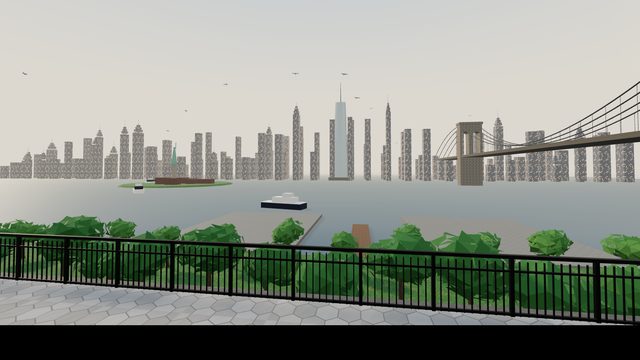
The Brooklyn Heights Promenade: a third of a mile of hexagonal block pavement and iron railing cantilevered over the two decks of the Brooklyn Queens Expressway, with Brooklyn Bridge Park and the harbour below and all of Lower Manhattan straight across the water. Behind you the gardens and the backs of the Heights houses, beside you the benches, the dog walkers and the kids on scooters, and under your feet the traffic you can hear but only glimpse through the railing. The New Yorkers hang on the garden fences facing the walk, on the walls of the Montague Street entrance and in the pergola at the north end.
The Brooklyn Heights Promenade is a 1,826 foot platform and pedestrian walkway cantilevered over the Brooklyn Queens Expressway, Interstate 278, running from the west end of Remsen Street to the west end of Orange Street, with views of the Lower Manhattan skyline and New York Harbor. Its southern half opened to the public on October 7, 1950 and its northern half on December 7, 1951. The leaders of the Brooklyn Heights Association, Roy M. D. Richardson and Ferdinand W. Nitardy among them, lobbied for a route that moved the highway westward to run along the escarpment above the water, and the engineers of Andrews and Clark, the firm commissioned to build the highway, backed that route because it cost less; the two tiered section in Brooklyn Heights that Robert Moses designed had originally been planned to go straight through Hicks Street. It can be reached from Montague Street and Pierrepont Place and from the west ends of Pierrepont Street, Clark Street and Pineapple Street. The construction of Brooklyn Bridge Park gave the foreground of the view a more landscape like look. Since October 2021 the expressway under it has been reduced to two lanes in each direction between Atlantic Avenue and the Brooklyn Bridge; the city's Department of Transportation began a repair project on the section in 2017, and in August 2026 the city government announced a proposal to spend about $4 billion repairing the existing cantilever over ten years.
Source · Brooklyn Heights Promenade and Brooklyn Queens Expressway, Wikipedia ↗
The iron railing and the hex block pavement, the benches facing the view, the flower beds and the garden fences with the brownstone and brick backs of the Heights houses above them, the two roadway decks stepping out below the walk with the expressway traffic on them, Furman Street and the lawns and piers of Brooklyn Bridge Park, the harbour with its ferries, Governors Island and the Statue of Liberty far to the south, the Brooklyn Bridge to the north, and the whole of Lower Manhattan with One World Trade across the river. Mood: late afternoon, the harbour going gold. Everything is procedural geometry with painted surfaces; nothing is a scan or a photograph. The room is an interpretation, and it hangs the New Yorkers the census recorded at this place first.